Rugged GPS/GLONASS with 8 Megapixel Camera and Preloaded TOPO Maps
- 4-inch dual-orientation, glove-friendly touchscreen display
- 8 megapixel autofocus camera; automatically geotags photos
- Tracks both GPS and GLONASS satellites
- Preloaded TOPO U.S. 100K maps; includes 1-year BirdsEye Satellite Imagery subscription
- 3-axis compass with barometric altimeter
Montana 680t features a dual-orientation, color touchscreen that’s glove friendly, comes preloaded with TOPO U.S. 100K maps and includes a 1-year BirdsEye Satellite Imagery subscription. The digital camera provides high-quality images, excellent resolution and automatically geotags photos with coordinates.
The handheld includes 3-axis tilt-compensated compass, barometric altimeter and access to both GPS and GLONASS satellites for improved positioning and typically faster fixes.
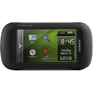
Enjoy the ViewMontana 680t has a vast 4-inch, sunlight-readable touchscreen display, giving you vivid colors and high-resolution images. Its easy-to-use touchscreen means you’ll spend more time enjoying the outdoors and less time searching for information.
Take Geotagged Pictures
Capture locations and memories with Montana 680t’s 8 megapixel digital camera. Each photo is automatically geotagged with coordinates, allowing you to navigate back to that exact spot in the future. Keep track of your photos and see their locations on a map using BaseCamp™. Insert a microSD™ card for more photo storage or to view pictures from other devices.
Mount AnywhereWith an array of compatible mounts, Montana 680t is designed for use on ATVs, in boats, as a handheld or in your car or RV. Use the auto mount with City Navigator® NT maps for spoken, turn-by-turn driving directions or the rugged mount for your motorcycle or ATV.
Go Everywhere
Adding more maps to Montana is easy. Download TOPO U.S. 24K maps and hit the trail, plug in BlueChart® g2 preloaded cards for a day on the water or load City Navigator map data for turn-by-turn driving directions. Add satellite images to your maps with BirdsEye Satellite Imagery (1-year subscription included). Or, transform paper maps into files you can download to your Montana with Custom Maps.
Share WirelesslyWith Montana 680t, you can share your waypoints, tracks, routes and geocaches wirelessly with other compatible Garmin GPS users. Just press “send” to transfer your information to similar devices and let the games begin.
Keep Your Fix
With its high-sensitivity GPS and GLONASS reception, WAAS-enabled receiver and HotFix® satellite prediction, Montana 680t locates your position quickly and precisely and maintains it. Whether you’re in deep woods or just near tall buildings and trees, you can count on Montana 680t.
Navigate with EaseMontana 680t has a built-in 3-axis tilt-compensated electronic compass, which shows your heading even while you’re on the move or not holding it level. The barometric altimeter tracks changes in pressure to pinpoint your precise altitude, or use it to plot barometric pressure over time to help keep an eye on changing weather conditions.
Double Your PowerWith a one-of-a-kind dual battery system, the 680t gives you the option of using the rechargeable lithium-ion pack or traditional AA batteries.
Note:
- The full product specifications below are from the manufacturer and may contain information related to other package quantities that will not apply to the product that you are reviewing. Please confirm the actual content and/or package quantity from the main product specifications page.
- These specifications may represent the entire product series/model/line to which this product belongs with specific configuration differences between the individual products stated.
- These specifications may have been copied from the same product in other region/country in which case there might be minor differences in region-specific data such as Input Voltage, Terms of Warranty etc.
Physical & Performance
Physical dimensions: 2.9" x 5.7" x 1.4" (7.48 x 14.42 x 3.64 cm)
Display size, WxH: 2"W x 3.5"H (5.06 x 8.93 cm); 4" diag (10.2 cm)
Display resolution, WxH: 272 x 480 pixels
Display type: bright, transflective 65k color TFT, dual-orientation touchscreen; sunlight readable
Touchscreen: yes
Weight: 10.2 oz (289 g) with included lithium-ion battery pack; 11.7 oz (333 g) with 3 AA batteries (not included)
Battery: rechargeable lithium-ion (included) or 3 AA batteries (not included); NiMH or Lithium recommended
Battery life: up to 16 hours (lithium-ion); up to 22 hours (AA batteries)
Water rating: IPX7
High-sensitivity receiver: yes
Interface: high-speed USB and NMEA 0183 compatible
Camera: yes (8 megapixel with autofocus; automatic geo-tagging)
Barometric altimeter: yes
Electronic compass: Yes (tilt-compensated 3-axis)
Unit-to-unit transfer (shares data wirelessly with similar units): yes
Maps & Memory
Basemap: yes
Preloaded maps: yes (topographic)
Ability to add maps: yes
Built-in memory: 8 GB
Accepts data cards: microSD™ card (not included)
Custom POIs (ability to add additional points of interest): yes
Waypoints/favorites/locations: 4000
Routes: 200
Track log: 10,000 points, 200 saved tracks
Outdoor Features
Automatic routing (turn by turn routing on roads): Yes (with optional mapping for detailed roads)
Geocaching-friendly: Yes (Paperless)
Custom maps compatible: yes
Hunt/fish calendar: yes
Sun and moon information: yes
Tide tables: Yes (with optional Bluechart)
Area calculation: yes
Picture viewer: yes
Garmin Connect™
Garmin Connect™ compatible (online community where you analyze, categorize and share data): yes